Excerpt: (C)itizen science provides a way to question how science is done and who is doing it. Within citizen science, it is important to notice that scientific degrees don’t always translate to leadership. The keynotes speakers were Dr. Marc Edwards (Virgina Tech) &  LeeAnne Walters (Coalition for Clean Water). Marc started in an area of research about home water systems and was approached about lead contamination in a case before Flint that got him engaged with community issues. LeeAnne gave a back story of Flint – the change in the water source to the Flint river, leading to a deteriorating quality of water – people getting sick, and having health impacts across the city. This was ignored by the city authorities and the community members were described as liars and stupid. That was the point where she decided to learn about the science – got through a lot of learning about water distribution system. In April 2015 in interaction with professionals, she pointed that “I’m not a scientist, but I am trying to be” and with EPA being shocked about the results from the water. They started to work with Marc in 2015 and when they put the report in that year the EPA apologized to the city authorities about releasing information to the public. In late 2015 they did a city-wide study in 2015 with NSF funding to carry out a 300 houses studies across the city.

Source: Haklay, M., 2017. Citizen Science 2017 – Day 1 (Morning): Flint Water Study, EPA use of citizen science and engagement, 19 May. Available at https://povesham.wordpress.com/2017/05/19/citizen-science-2017-day-1-morning-flint-water-study-epa-use-of-citizen-science-and-engagement/[Last accessed 5 June 2017].
Abstract: Data collection, storage, analysis, visualization, and dissemination are changing rapidly due to advances in new technologies driven by computer science and universal access to the internet. These technologies and web connections place human observers front and center in citizen science-driven research and are critical in generating new discoveries and innovation in such fields as astronomy, biodiversity, and meteorology. Research projects utilizing a citizen science approach address scientific problems at regional, continental, and even global scales otherwise impossible for a single lab or even a small collection of academic researchers. Here we describe eButterfly, an integrative checklist-based butterfly monitoring and database web-platform that leverages the skills and knowledge of recreational butterfly enthusiasts to create a globally accessible unified database of butterfly observations across North America. Citizen scientists, conservationists, policy makers, and scientists are using eButterfly data to better understand the biological patterns of butterfly species diversity and how environmental conditions shape these patterns in space and time. eButterfly in collaboration with thousands of butterfly enthusiasts has created a near real-time butterfly data resource producing tens of thousands of observations per year open to all to share and explore.

Source: Prudic, K.L., McFarland, K.P., Oliver, J.C., Hutchinson, R.A., Long, E.C., Kerr, J.T., Larrivée, M., 2017. eButterfly: Leveraging Massive Online Citizen Science for Butterfly Conservation. Insects 8(2): 53. DOI: 10.3390/insects8020053

Abstract: Citizen participation in online communities of scientific investigations has recently become more popular. Enhancing the engagement of citizens within these communities is a focus of attention for researchers and practitioners who want to amplify the impact on learning, science and society. This study investigates the relationship between engagement factors and behaviour patterns in an online community that requires high levels of citizen participation. While other studies explore engagement in communities where citizens contribute data, the current research investigates a community to support citizens in facilitating their own scientific investigations. Data were collected from log files and questionnaires, and multiple measures of engagement were examined: engagement metrics, roles, motivation, attitude, satisfaction and belonging to the community. The results allowed comparison of the engagement levels among different types of citizen participation communities and categorised members in engagement profiles, according to their behaviour patterns. Findings indicate a need for differing design approaches based on the type of citizen participation community and individual engagement profiles.

Source: Aristeidou, M., Scanlon, E., Sharples, M., 2017. Profiles of engagement in online communities of citizen science participation. Computers in Human Behavior 74: 246-256. DOI: https://doi.org/10.1016/j.chb.2017.04.044

Summary: In Citizen Science, members of the general public collaborate with scientists to generate and use data relating to the natural world. For the many fields of marine research, this is a particularly powerful approach which should not be overlooked. The sheer scale of coastal and ocean environments mean that it would take several lifetimes for scientists to study them alone. By collaborating with citizens, a much greater number of people can be mobilized to gather a wealth of data and develop new scientific knowledge and understanding. The variety of data types which are amenable to Citizen Science, as outlined in the position paper, are great, meaning that there could be a project to suit everyone. Citizen Science can also enable participants to improve their Ocean Literacy, gain new skills and experiences, and can also empower them to participate in the process of delivering future marine policy.

Now, more than ever, marine science research is needed to understand the impacts of a world undergoing change. The rise of Marine Citizen Science to help address this need is therefore timely. This paper highlights opportunities, challenges and best practice in Marine Citizen Science, and sets out a list of high-level strategic recommendations for the future development of Marine Citizen Science in Europe. It presents examples of existing Marine Citizen Science initiatives in Europe to illustrate good practice. Common concerns such as data quality and maintaining engagement are discussed, as are future opportunities such as increased use of technology and potential role of Marine Citizen Science in informing marine policy and conservation. The paper closes with a list of high-level strategic recommendations for the future development of Marine Citizen Science in Europe.

Source: European Marine Board, 2017. Garcia-Soto, C., van der Meeren, G. I., Busch, J. A., Delany, J., Domegan, C., Dubsky, K., Fauville, G., Gorsky, G., von Juterzenka, K., Malfatti, F., Mannaerts, G., McHugh, P., Monestiez, P., Seys, J., Węsławski, J.M. & Zielinski, O. (2017) Advancing Citizen Science for Coastal and Ocean Research. French, V., Kellett, P., Delany, J., McDonough, N. [Eds.] Position Paper 23 of the European Marine Board, Ostend, Belgium. 112pp. ISBN: 978-94-92043-30-6

Abstract: This paper presents an observatory for registering applications that use participatory sensing to collect data. Cataloging these applications will aid the scientific community to exchange more information, facilitating the comparison between different initiatives. Through an initial research, the applications are categorized in areas usually considered in the literature. We propose a survey to validate the platform and also discuss the taxonomies created as a result of this survey. The main contributions of this paper include the classification of crowdsensing applications in different ontological categories, as well as the proposal of a technology platform that enables the distributed and collaborative cataloging of crowdsensing initiatives.

Source: Melo, G., Oliveira, L., Schneider, D., de Souza, J., 2017. Towards an observatory for mobile participatory sensing applications. In: 21st International Conference on Computer Supported Cooperative Work in Design, Wellington, New Zealand. April 2017.

Abstract: The validity of the threat status assigned to a species by the International Union for Conservation of Nature’s (IUCN) Red List relies heavily on the accuracy of the geographic range size estimate for that species. Range maps used to assess threat status often contain large areas of unsuitable habitat, thereby overestimating range and underestimating threat. In this study, we assessed 18 endemic birds of the Western Ghats to test the accuracy of the geographic range sizes used by the IUCN for their threat assessment. Using independently reviewed data from the world’s largest citizen science database (eBird) within a species distribution modeling framework, our results show that: (a) geographic ranges have been vastly overestimated by IUCN for 17 of the 18 endemic bird species; (b) range maps used by IUCN contain large areas of unsuitable habitat, and (c) ranges estimated in this study suggest provisional uplisting of IUCN threat status for at least 10 of the 18 species based on area metrics used by the IUCN for threat assessment. Since global range size is an important parameter for assigning IUCN threat status, citizen science datasets, high resolution and freely available geo-referenced ecological data, and the latest species distribution modeling techniques should be used to estimate and track changes in range extent whenever possible. The methods used here to significantly revise range estimates have important conservation management implications not only for endemic birds in the Western Ghats, but for vertebrate and invertebrate taxa worldwide.

Source: Ramesh, V., Gopalakrishna, T., Barve, S., Melnick, D.J., 2017. IUCN greatly underestimates threat levels of endemic birds in the Western Ghats. Biological Conservation, 210(Part A): 205–221. DOI: https://doi.org/10.1016/j.biocon.2017.03.01

Abstract: Changing land cover and climate regimes modify water quantity and quality in natural stream systems. In regions undergoing rapid change, it is difficult to effectively monitor and quantify these impacts at local to regional scales. In Vancouver, British Columbia, one of the most rapidly urbanizing areas in Canada, 750 measurements were taken from a total of 81 unique sampling sites representing 49 streams located in urban, forest, and agricultural-dominant watersheds at a frequency of up to 12 times per year between 2013 and 2016. Dissolved nitrate (NO3-N) and phosphate (PO4-P) concentrations, turbidity, water temperature, pH and conductivity were measured by citizen scientists in addition to observations of hydrology, vegetation, land use, and visible stream impacts. Land cover was mapped at a 15-m resolution using Landsat 8 OLI imagery and used to determine dominant land cover for each watershed in which a sample was recorded. Regional, seasonal, and catchment-type trends in measurements were determined using statistical analyses. The relationships of nutrients to land cover varied seasonally and on a catchment-type basis. Nitrate showed seasonal highs in winter and lows in summer, though phosphate had less seasonal variation. Overall, nitrate concentrations were positively associated to agriculture and deciduous forest and negatively associated with coniferous forest. In contrast, phosphate concentrations were positively associated with agricultural, deciduous forest, and disturbed land cover and negatively associated with urban land cover. Both urban and agricultural land cover were significantly associated with an increase in water conductivity. Increased forest land cover was associated with better water quality, including lower turbidity, conductivity, and water temperature. This study showed the importance of high resolution sampling in understanding seasonal and spatial dynamics of stream water quality, made possible with the large number of measurements taken with the help of trained volunteers. The results underscore the value of citizen science in freshwater research.

Source: High resolution stream water quality assessment in the Vancouver, British Columbia region: a citizen science study

Abstract: Despite the growing volume of available transportation data and the efforts of many cities to increase cycling levels, there remains a lack of data on where people cycle. The use of GPS trajectories have now been used in cycle studies for several years, and more recently large, crowdsourced datasets of GPS recorded cycle trips have become available and of interest to transportation and planning departments. However, there is limited research on how representative these new crowdsourced data sources are of the general cycling population.

This study uses GPS trip data from a GPS data crowdsourcing project called the Bike Data Project. It prepares a dataset of GPS for the city of Lund, Sweden and matches the trips to a street network dataset. The study creates cycle counts based on the GPS trajectories for locations through the study area and compares these to manual counts made at the same location. No correlation was found between the counts, suggesting that the GPS trajectory data set is not a reliable representation of cycle trips within the study area, likely due to a lack of unique users within the dataset. The study plugs a gap in the current literature by quantitatively testing the accuracy of different map matching algorithms for matching cycling GPS data to the street network, by comparing them to ground truth trips of the actual routes taken, in the first example of this for cycle data. It is found that in certain situations in dense networks the matching cannot be relied upon to give the correct link, which could have implications for studies looking to quantify the percentage of cycling taking place on different road infrastructure types.

Source: Preparation and analysis of crowdsourced GPS bicycling data : a study of Skåne, Sweden

Abstract: Citizen science—the involvement of volunteers in data collection, analysis and interpretation—simultaneously supports research and public engagement with science, and its profile is rapidly rising. Citizen science represents a diverse range of approaches, but until now this diversity has not been quantitatively explored. We conducted a systematic internet search and discovered 509 environmental and ecological citizen science projects. We scored each project for 32 attributes based on publicly obtainable information and used multiple factor analysis to summarise this variation to assess citizen science approaches. We found that projects varied according to their methodological approach from ‘mass participation’ (e.g. easy participation by anyone anywhere) to ‘systematic monitoring’ (e.g. trained volunteers repeatedly sampling at specific locations). They also varied in complexity from approaches that are ‘simple’ to those that are ‘elaborate’ (e.g. provide lots of support to gather rich, detailed datasets). There was a separate cluster of entirely computer-based projects but, in general, we found that the range of citizen science projects in ecology and the environment showed continuous variation and cannot be neatly categorised into distinct types of activity. While the diversity of projects begun in each time period (pre 1990, 1990–99, 2000–09 and 2010–13) has not increased, we found that projects tended to have become increasingly different from each other as time progressed (possibly due to changing opportunities, including technological innovation). Most projects were still active so consequently we found that the overall diversity of active projects (available for participation) increased as time progressed. Overall, understanding the landscape of citizen science in ecology and the environment (and its change over time) is valuable because it informs the comparative evaluation of the ‘success’ of different citizen science approaches. Comparative evaluation provides an evidence-base to inform the future development of citizen science activities.

Source: The diversity and evolution of ecological and environmental citizen science

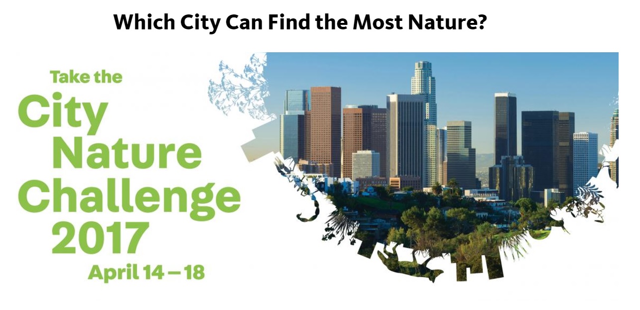
How can museums advance citizen science? The City Nature Challenge makes evident at least three themes: First, a belief that “science is open to all” is consistent with museums’ values of inclusivity and access. Second, museums know partnerships. (To realize this competitive bioblitz event, the California Academy of Sciences and the Natural History Museum of Los Angeles County enlisted a number of peer museums, NGOs, universities and colleges and other organizations across the U.S..) Third, museum workers strive to protect, interpret, and share resources that are held in the public trust, resources such as knowledge and nature that enrich public life and are the domain of the public sector. — AWA —

Excerpt: In its first year in 2016, a friendly nature challenge pitted Los Angeles and San Francisco in head-to-head competition that sent citizen scientists combing their backyards and local parks for urban wildlife. The idea is to recruit citizens — no training is necessary — to head out to see what they can find in nature, from worms to lizards to mountain lions.

“It’s a win-win for everybody,” said Lori Bettison-Varga, president and director of the Los Angeles County Natural History Museum. “Our researchers get data from places they can’t canvas, and Angelenos interact with the nature around them, make discoveries and collaborate with scientists.

“It conveys the idea that science is not a rarefied thing, it’s accessible to everyone, and it’s incredibly fun.”

City Nature Challenge 2017 website header, Natural History Museum of Los Angeles County (nhm.org)

Image credit: Natural History Museum of Los Angeles County website

Source: What’s in the dirt? City Nature Challenge will send citizen scientists afield